My Expertise
Radar remote sensing, mine subsidence, urban subsidence.
Keywords
Fields of Research (FoR)
Photogrammetry and Remote Sensing, Signal Processing, Geomatic Engineering, Image Processing, Sensory Systems, Artificial Intelligence and Image Processing not elsewhere classified, Artificial Intelligence and Image ProcessingSEO tags
Biography
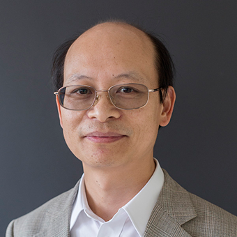
Linlin is currently a Professor of remote sensing and earth observation in the School of Civil and Environmental Engineering at the University of New South Wales (UNSW), Sydney, Australia. He has been studying earth observation techniques since 1985. Among many other prestigious awards, Professor Ge and his team’s work to support the Sichuan Earthquake rescue effort won them the highly prestigious JK Barrie Award for Overall Excellence at...view more
Linlin is currently a Professor of remote sensing and earth observation in the School of Civil and Environmental Engineering at the University of New South Wales (UNSW), Sydney, Australia. He has been studying earth observation techniques since 1985. Among many other prestigious awards, Professor Ge and his team’s work to support the Sichuan Earthquake rescue effort won them the highly prestigious JK Barrie Award for Overall Excellence at the 2008 Asia-Pacific Spatial Excellence Awards. He was named "NSW Scientist of the Year 2009" in the category Physics, Earth Sciences, Chemistry and Astronomy for his work in near real-time satellite remote sensing.
He received his PhD in GPS and remote sensing from UNSW, Sydney, MSc in Crustal Deformation from the Institute of Seismology, and BEng (1st Hons and University Medal) in Optical Engineering from the Wuhan Technical University of Surveying and Mapping
Linlin is a foundation member of the Surveying and Spatial Sciences Institute. He is a Member of the IEEE (the Institute of Electrical and Electronics Engineers, Inc.) and a Life Member of the AGU (the American Geophysical Union). He is also a Principal Investigator for satellite missions such as Envisat, ALOS, COSMO-SkyMed, Radarsat-2 and ALOS-2.
Professor in the School of Civil and Environmental Engineering
Research interest
Level 1: I use digital images to map the surface of the Earth
Level 2: I combine remote sensing with GPS and GIS to produce cost-effective and highly reliable maps
Level 3: Integrating radar and optical remote sensing with GPS and GIS, we measure the subtle change on the surface of the Earth with minimum latency using data collected from satellite, airborne and UAV platforms
Interest in engineering
Why did you get into engineering?
Engineering delivers practical and innovative solutions to difficult problems in our daily life
What are your research goals?
To make remote sensing more timely, accurate, affordable and widely applicable
What do people not understand about you do?
Remote sensing, especially satellite remote sensing, is perceived as high tech and hence hard to study and difficult to be applied in daily life.
Advice for prospective Civil & Environmental engineers
Because of the significant progress in micro-electronics and computing, remote sensing has become the most cost-effective and efficient way to support Civil & Environmental engineering and other engineering disciplines.
Lectures/Courses taught
Principles of Remote Sensing
Radar Remote Sensing
Earth Observation System and Applications
Remote Sensing and Photogrammetry
Surveying for Civil Engineers
Surveying for Mining Engineers
Surveying and GIS
Electronic Surveying Instrumentation
Students
Number currently in lab: 5
Number graduated: 25
Student Projects:
Persistent scatterer radar interferometry (PSI)
Differential radar interferometry (DInSAR)
Interferometric synthetic aperture radar (InSAR)
Integration of InSAR, GPS and GIS
Remote sensing with satellite, airborne and UAV platforms
Remote sensing with multi-temporal imagery
Remote sensing with sub-pixel analysis
Near-real-time satellite remote sensing
Remote sensing applications in natural disaster monitoring
Looking for students for projects related to:
Persistent scatterer radar interferometry
Near-real-time satellite remote sensing
Remote sensing applications in natural disaster monitoring
Digital image processing
Sensor networks
Internet of Things (IoT)
Intelligent Transport Systems (ITS)
Smart Cities
Natural disaster mitigation (bushfire, flood, landslide and earthquake)
Professional Organisations and Consulting positions
2011 - present
The CEOS WGCV SAR Subgroup (Working Group on Calibration and Validation, Synthetic Aperture Radar Subgroup, The Committee on Earth Observation Satellites)
2008 - present
Member, Remote Sensing Sub Committee, the Data and Information Management Working Group, New South Wales, Australia (a NSW Government cluster group comprising NSW Government agencies in the natural resources and planning sectors).
2008 - 2012
Member, Spatial Governance Committee, Department of Lands, New South Wales, Australia
2008 - 2012
International Society for Photogrammetry and Remote Sensing Working Group V/I on Land-based mobile mapping systems
2008 - present
Chair, Study Group 6.2 Optimal Use of InSAR, International Federation of Surveyors
2004 - present
Foundation Member, SSI (the Spatial Sciences Institute, Australia)
2002 - present
Member, IEEE (the Institute of Electrical and Electronics Engineers, Inc.)
2002 - present
Life Member, AGU (the American Geophysical Union)
Awards, Grants, Patents
Awards
2010 UNSW Inventor of the Year, finalist in the category: Information and Communication Technology
NSW Scientist of the Year 2009 Award in the Physics, Earth Sciences, Chemistry and Astronomy Category
University of New South Wales Research Showcase Best Poster Award, 2009
Asia-Pacific Spatial Excellence Awards - the J K Barrie Award for Overall Excellence, 2008
Asia-Pacific Spatial Excellence Awards – People and Community, 2008
NSW Awards for Excellence in Surveying and Spatial Information, Finalist, 2008
Asia-Pacific Spatial Excellence Awards, Finalist, 2005
The Australian Research Council Postdoctoral Fellowship, 2002-2004
Best Tutor Prize, School of Geomatic Engineering, University of New South Wales, Australia, 2001
Best Student Paper Award, the U.S. Institute of Navigation, USA, 1999
Top-up Postgraduate Scholarship, School of Geomatic Engineering, University of New South Wales, Australia, 1998-2000
Supplementary Engineering Postgraduate Award (SEPA), Faculty of Engineering, University of New South Wales, Australia, 1998-2000
International Postgraduate Research Scholarship (IPRS), Commonwealth of Australia, 1998-2000
Postdoctoral Fellowship, Meteorological Research Institute, the Science & Technology Agency, Japan, 1997-1998
Current Grants
ARC Discovery grant “Advanced techniques for imaging radar interferometry”
Australian Space Research Program “SAR Formation Flying”
ARC Super Science Fellow “Towards operational monitoring of key climate parameters from synthetic aperture radar”
GDF SUEZ Energy Australia, "Monitoring subsidence in Hazelwood Mine with Advanced Persistent Scatterer Interferometry"
Lower Murray Darling Catchment Management Authority, "Flood mapping with satellite SAR"
CO2CRC, "InSAR mapping of Otway and Iona sites"
Victoria Department of Sustainability and Environment, "Monitoring Subsidence in Gippsland with InSAR"
Australia-China Group Mission, "Monitoring Mining Environment with Satellite Remote Sensing"
ARC-Linkage,"Measurement of paddock scale pasture biomass using synthetic aperture radar remote sensing"
Ministry of Science and Technology, China, "Satellite SAR for monitoring illegal mining activities"
ARC-Linkage, "A new approach to structural design that incorporates the effect of non-structural components"
Queensland, Victorian, Western Australia, and New South Wales governments, "Near real-time flood mapping with satellite SAR"
Department of Resources, Energy and Tourism, Joint Coordination Group on Clean Coal Technology (JCG), "Integrated radar and optical satellite remote sensing for safeguarding carbon capture and storage"
Education
PhD/postgraduate
Ph.D., University of New South Wales, Sydney, Australia.
M.Sc., Institute of Seismology, China Seismological Bureau, Wuhan, P.R. China.
Undergraduate
B.Eng. (1st Hons. and University Medal), Wuhan Technical University of Surveying & Mapping, Wuhan, P.R. China.
Contact
Publications
ORCID as entered in ROS
Research Activities
To maintain the long-term viability of livestock production, producers and land managers need access to regular, timely and accurate estimates of pasture biomass. Radar remote sensing has the capacity to consistently provide this information at the paddock, farm and catchment scale in a timely manner to assist in tactical and strategic decision making for sustainable pasture and livestock management. Economic analyses undertaken at the farm level have revealed the potential to double farm profit by increasing the utilization of pasture grown. In addition to the socio-economic benefits, the…
